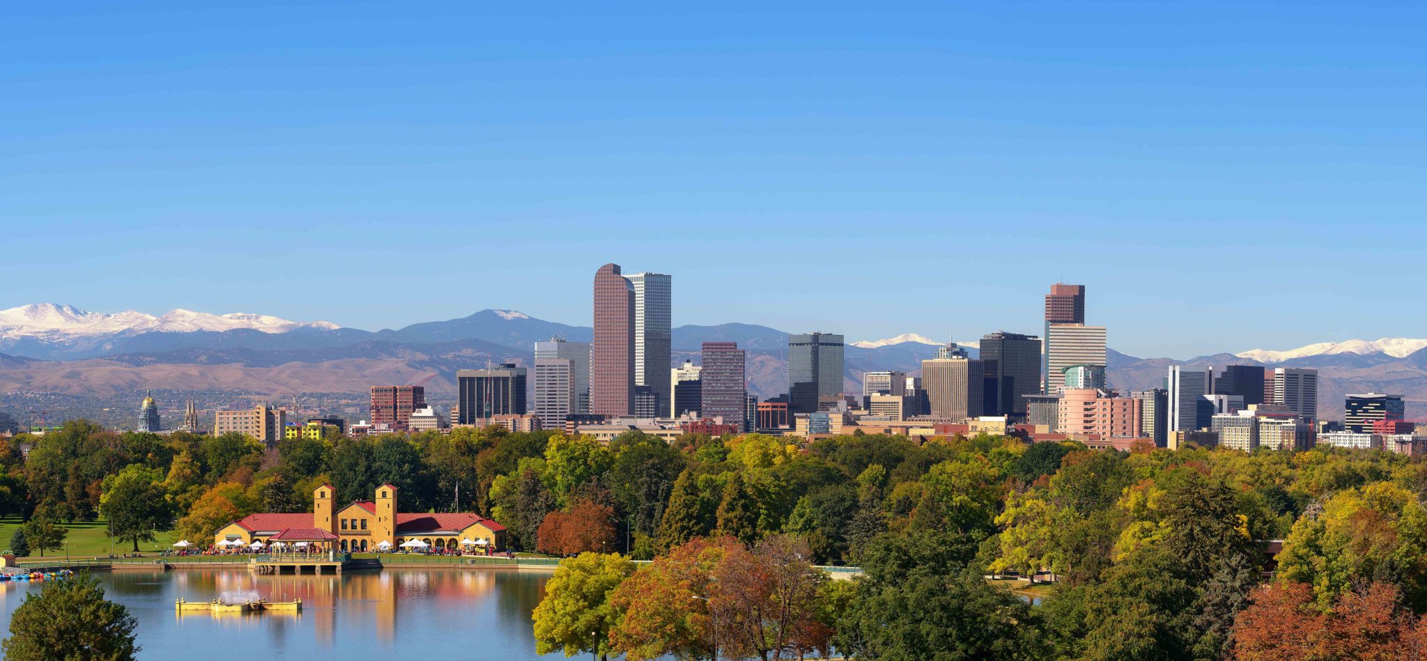
Denver, with the scenic Front Range of the Rockies stretching across the horizon. The golden dome of the Colorado state capital building is visible to the left.
By Robert Vallera CCIM
• The Front Range What, Where?
• Why Is The Front Range Thriving?
• Transportation Challenges, and Potential Solutions
• Escaping The NIMBY Trap
Will Anything Stop This Train?
Colorado’s Front Range Urban Corridor has the ability to become one of America’s most successful regions in the first half of this 21st Century. Will it fulfill this potential?
Located at the far western edge of the Great Plains, the region’s moniker recalls the perspective of early travelers from the east as they confronted the Rocky Mountains. The highest peaks of the range are set off against the western sky, rising over 9,000 feet above the plains. Rough-hewn mountain men pursuing beaver pelts, then miners, cattle ranchers and farmers played key roles in the exploration and early development of the area.
An Educated Population With Attractive Lifestyle Opportunities
For investors, the attraction of the Front Range region is that its growing, diversified economy and abundant recreational opportunities attract and retain one of the most highly-educated workforces in the nation. Denver ranks 7th among U.S. metro areas for educational attainment, with a college graduation rate of 39.2%. Similarly, Colorado ranks #2 among the fifty states with 37% of the population being college educated.
In 2015, Denver ranked No. 1 on Forbes’ list of the Best Places for Business and Careers. While some local residents voice concerns about rising housing costs, home prices are roughly one-half of those on the West Coast. Let’s see now, might all of these factors attract more than a few ambitious and motivated Millennials?

The Lay of the Land
While the climate along the Front Range corridor is considered semi-arid, any skier can attest to the region’s true four-seasons climate. The summers are far less humid and the winters offer dramatically more sunshine than most of the central and eastern parts of the country. Most residents live within 2 – 20 miles of the foothills of the Rocky Mountains. They enjoy easy access to an abundance of options for hiking, mountain-biking, rock climbing, and skiing. The weather is typically cooperative for whichever activity is in-season.
The Front Range Corridor is unique in being the most isolated population center of its size in the continental United States. The closest metropolitan regions with populations exceeding 1-million are Salt Lake City some 520 miles to the west and Albuquerque, 449 miles to the south. This relative isolation increases both the sense of regional identity and Denver’s importance as a freight and transportation hub.
The corridor’s principal cities follow Interstate 25 from Pueblo, Colorado north to Cheyenne, Wyoming. The vast majority of the population is concentrated between Colorado Springs, 69 miles south of Denver to Fort Collins, Colorado, located 65 miles north of Denver. Stay tuned for future Urban Navigator articles exploring this 134 mile-long Colorado Springs-Denver-Fort Collins section of the corridor.
Population Growth = Transportation Challenges, and Potential Solutions
There are indications that West Coast cities might be able to learn a few lessons to help alleviate their own growing pains by following some of the transportation and land use policies being employed in and around Denver.
The current population within Denver’s city limits is only 704,000, although the greater Denver-Boulder primary metropolitan statistical area is home to 3.1-million people. The entire Colorado Springs to Fort Collins corridor is home to 4.5-million residents, an increase of almost 1.1-million residents since the year 2000. Some 80% of Colorado’s total population now resides along the Front Range Urban Corridor. The region is expected to grow by 43%, adding 2-million new residents within the next twenty years
Of course, with this spectacular growth comes the inevitable challenge to provide sufficient transportation infrastructure to maintain mobility within the Front Range Corridor. In addition to ongoing freeway improvements, Denver’s Regional Transportation District now operates nine commuter and light rail lines servicing 53 stations along the Denver’s North, East, Southeast, Southwest, and West rail corridors. They are also constructing the voter-approved FasTracks transit expansion that will add 122 miles of new commuter rail and light rail, 18 miles of rapid transit bus service, and 21,000 new parking spaces at rail and bus stations.
Dense, transit-oriented mixed-use development is being encouraged near transit stations, and developers are responding. The concentration of potential transit riders within walking distance of the stations is critical to the long-run success of the rail lines and the retention of mobility within the region. Even casual observations reveal large amounts of multi-family development in close proximity to a number of transit stations in and around Denver. The region appears to be escaping the NIMBY trap that threatens to ossify some West Coast cities with their reluctant to accept new housing development even in close proximity to commuter rail stations.
What’s Next?
The Urban Navigator will be visiting specific neighborhoods in Denver, Colorado Springs and Fort Collins. We’ll see if our field research can locate opportunities for investors to participate in the growing success along the Front Range Urban Corridor.


Leave a Reply